DLR
EOC
Sentinel-2
Land cover
Vegetation cover
Soil cover
Multispectral Imaging
Netherlands
opendata
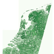
The Sentinel-2 fractional vegetation cover (fCover) product for the Netherlands was produced as part of the NextGEOSS project at the German Aerospace Center (DLR). The goal is to derive abundance maps from atmospherically corrected Sentinel-2 multispectral images for photosynthetically active vegetation (PV), combined non-photosynthetically active vegetation (NPV) and bare soil (BS).
Contacts:
- David Marshall (Producer, Processor) DLR/EOC Photogrammetry and Image Analysis
- Uta Heiden (Producer, Processor) DLR/EOC Photogrammetry and Image Analysis
Properties:
Items:
Sentinel-2 fractional vegetation cover (fCover) product for the Netherlands generated by processing 10 cloud-free Sentinel-2 tiles which covered the country on 8 September 2016.


