Skip navigation

DLR
EOC
Satellite
Earth Observation
Multispectral
Sentinel-2
MSI
Level 2A
MAJA
Atmospheric Correction
Cloud Detection
Germany

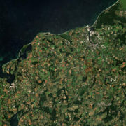
This collection contains Sentinel-2 Level 2A surface reflectances, which are computed for the country of Germany using the time-series based MAJA processor. The MAJA product offers an alternative to the official ESA L2A product and has been processed with consideration of the characteristics of the Sentinel-2 mission (fast collection of time series, constant sensor perspective, and global coverage).

Assumptions about the temporal constancy of the ground cover are taken into account for a robust detection of clouds and a more flexible determination of aerosol properties. As a result, an improved determination of the reflectance of sunlight at the earth's surface (pixel values of the multispectral image) is derived. Further Sentinel-2 Level 2A data computed using MAJA are available on the the website.

References:

  • Olivier Hagolle, Mireille Huc, Camille Desjardins, Stefan Auer, & Rudolf Richter. MAJA Algorithm Theoretical Basis Document (Version 1.0, 2017, December 7) Link

Contacts:

Properties:

Items:

Sentinel-2 L2A FRE (MAJA)

Surface reflectance, corrected for atmospheric effects, including adjacency effects and slope effects. All 10 and 20 m Sentinel 2 bands are available. The reflectance is scaled by a factor of 10000.

Title: Sentinel-2 L2A MAJA Coverages
Endpoint: https://geoservice.dlr.de/eoc/imagery/wcs
Coverage: imagery__S2_L2A_MAJA_FRE
Capabilities: GetCapabilities (XML)
DescribeCoverage: DescribeCoverage (XML)
Preview: GetCoverage

Title: Sentinel-2 L2A MAJA WMS Layers
Endpoint: https://geoservice.dlr.de/eoc/imagery/wms
Layer: S2_L2A_MAJA_FRE
Capabilities: GetCapabilities (XML)
Preview: GetMap (Openlayers)

Title: WMTS
Endpoint: https://{s}.geoservice.dlr.de/eoc/gwc/service/wmts (s=a,b,c,d,e,f)
Layer: imagery:S2_L2A_MAJA_FRE
Capabilities: GetCapabilities (XML)
Preview: GetTile (Openlayers)

Sentinel-2 L2A MG2 (MAJA)

Bitwise geophysical mask: Bit 0: Water, Bit 1: All Clouds (except the thinnest), Bit 2: Snow, Bit 3: Shadows, Bit 4: Topographic Shadows, Bit 5: Unseen due to topography, Bit 6: Sun too low, Bit 7: Sun direction tangent to slope.

Title: Sentinel-2 L2A MAJA Coverages
Endpoint: https://geoservice.dlr.de/eoc/imagery/wcs
Coverage: imagery__S2_L2A_MAJA_MG2
Capabilities: GetCapabilities (XML)
DescribeCoverage: DescribeCoverage (XML)
Preview: GetCoverage

Title: Sentinel-2 L2A MAJA WMS Layers
Endpoint: https://geoservice.dlr.de/eoc/imagery/wms
Layer: S2_L2A_MAJA_MG2
Capabilities: GetCapabilities (XML)
Preview: GetMap (Openlayers)

Title: WMTS
Endpoint: https://{s}.geoservice.dlr.de/eoc/gwc/service/wmts (s=a,b,c,d,e,f)
Layer: imagery:S2_L2A_MAJA_MG2
Capabilities: GetCapabilities (XML)
Preview: GetTile (Openlayers)

Sentinel-2 L2A CLM (MAJA)

Detailed cloud mask.

Title: Sentinel-2 L2A MAJA Coverages
Endpoint: https://geoservice.dlr.de/eoc/imagery/wcs
Coverage: imagery__S2_L2A_MAJA_CLM
Capabilities: GetCapabilities (XML)
DescribeCoverage: DescribeCoverage (XML)
Preview: GetCoverage

Title: Sentinel-2 L2A MAJA WMS Layers
Endpoint: https://geoservice.dlr.de/eoc/imagery/wms
Layer: S2_L2A_MAJA_CLM
Capabilities: GetCapabilities (XML)
Preview: GetMap (Openlayers)

Title: WMTS
Endpoint: https://{s}.geoservice.dlr.de/eoc/gwc/service/wmts (s=a,b,c,d,e,f)
Layer: imagery:S2_L2A_MAJA_CLM
Capabilities: GetCapabilities (XML)
Preview: GetTile (Openlayers)

Related Datasets:

Sentinel-2 L3A WASP

2019-12-11