![]()
Release of the TanDEM-X 30m Edited DEM and 30m Change Maps in the EOC Geoservice
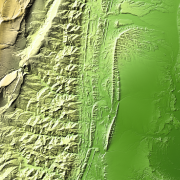
The 30m TanDEM-X products depict detailed information of the topographic height and changes over a certain time.
The DEM Change Maps [1] focus on the changes that have occurred during the years separating this new coverage from the coverages acquired to generate the TanDEM-X global DEM (between 2011 and 2014). The Change Maps are available in 30m posting and show height differences between the edited first global TanDEM-X DEM and the newly acquired time-tagged DEM scenes.
The TanDEM-X 30m Edited DEM [2] is a product variant of the Global Digital Elevation Model (DEM) acquired in the frame of the German TanDEM-X mission between 2010 and 2014, and has a reduced pixel spacing of 1 arcseconds (arsec), which corresponds to 30m at the equator.
The data will be accessible through the EOC Geoservice WMS and can be downloaded directly from the EOC Download Service. [3] [4]
Further information on the products can be found in the Data Guide. [5]


