DLR
EOC
TIMELINE
Land
AVHRR
Sentinel-1
The aim of the “Demand-driven Data Services for Humanitarian Aid” (Data4Human) project was to make geo-information from remote sensing data more usable for humanitarian relief missions and to tailor methods to the needs of humanitarian organizations.
Contacts:
- Nina Merkle (Producer, Processor) DLR/EOC Geo-Risks and Civil Security
Properties:
Items:
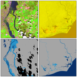
Identifies permanent water pixels. The reference water mask is derived by time-series analysis of archive imagery across a reference time-period.
Distinguish valid from invalid pixels. Invalid pixels are the result of no-data values in the satellite image and/or atmospheric obstructions such as clouds or cloud-shadows.
Identifies all water pixels in the satellite image. Water segmentation is done with a pre-trained convolutional neural network.


