Skip navigation

DLR
EOC
Enmap
Imagery
Hyperspectral
Level 0
Quicklooks

The Environmental Mapping and Analysis Program (EnMAP) is a German hyperspectral satellite mission that aims at monitoring and characterising the Earth's environment on a global scale. EnMAP measures and models key dynamic processes of Earth’s ecosystems by extracting geochemical, biochemical and biophysical parameters that provide information on the status and evolution of various terrestrial and aquatic ecosystems.

The mission's main objective is to study and decipher coupled environmental processes and to assist and promote the sustainable management of Earth's resources. This collection includes Level 0 quicklook images of the mission. For more information, please see the mission website: https://www.enmap.org/mission/

Contacts:

Properties:

Items:

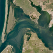
EnMAP HSI L0 Quicklooks VNIR

Visible and near-infrared (VNIR) quicklook radiometrically corrected for optimal displaying. Wavelength: 550 nm (blue), 670 nm (green), 850 nm (red)

Title: EnMAP L0 Quicklook WMS Layers
Endpoint: https://geoservice.dlr.de/eoc/imagery/wms
Layer: ENMAP_HSI_L0_QL_VNIR
Capabilities: GetCapabilities (XML)
Preview: GetMap (Openlayers)

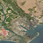
EnMAP HSI L0 Quicklooks SWIR

False color short-wavelength infrared (SWIR) quicklook radiometrically corrected for optimal displaying. Wavelength: 1050nm (blue), 1650nm (green), 2200nm (red)

Title: EnMAP L0 Quicklook WMS Layers
Endpoint: https://geoservice.dlr.de/eoc/imagery/wms
Layer: ENMAP_HSI_L0_QL_SWIR
Capabilities: GetCapabilities (XML)
Preview: GetMap (Openlayers)

EnMAP HSI L0 Quicklooks Quality Cloud

EnMAP HSI L0 Quicklook Cloud

Title: EnMAP L0 Quicklook WMS Layers
Endpoint: https://geoservice.dlr.de/eoc/imagery/wms
Layer: ENMAP_HSI_L0_QL_QUALITY_CLOUD
Capabilities: GetCapabilities (XML)
Preview: GetMap (Openlayers)

EnMAP HSI L0 Quicklooks Quality Cloudshadow

EnMAP HSI L0 Quicklook Cloud Shadow

Title: EnMAP L0 Quicklook WMS Layers
Endpoint: https://geoservice.dlr.de/eoc/imagery/wms
Layer: ENMAP_HSI_L0_QL_QUALITY_CLOUDSHADOW
Capabilities: GetCapabilities (XML)
Preview: GetMap (Openlayers)

EnMAP HSI L0 Quicklooks Quality Cirrus

EnMAP HSI L0 Quicklook Cirrus

Title: EnMAP L0 Quicklook WMS Layers
Endpoint: https://geoservice.dlr.de/eoc/imagery/wms
Layer: ENMAP_HSI_L0_QL_QUALITY_CIRRUS
Capabilities: GetCapabilities (XML)
Preview: GetMap (Openlayers)

EnMAP HSI L0 Quicklooks Quality Classes

EnMAP HSI L0 Quicklook Classes

Title: EnMAP L0 Quicklook WMS Layers
Endpoint: https://geoservice.dlr.de/eoc/imagery/wms
Layer: ENMAP_HSI_L0_QL_QUALITY_CLASSES
Capabilities: GetCapabilities (XML)
Preview: GetMap (Openlayers)

EnMAP HSI L0 Quicklooks Quality Haze

EnMAP HSI L0 Quicklook Haze

Title: EnMAP L0 Quicklook WMS Layers
Endpoint: https://geoservice.dlr.de/eoc/imagery/wms
Layer: ENMAP_HSI_L0_QL_QUALITY_HAZE
Capabilities: GetCapabilities (XML)
Preview: GetMap (Openlayers)

EnMAP HSI L0 Quicklooks Quality Snow

EnMAP HSI L0 Quicklook Quality Snow

Title: EnMAP L0 Quicklook WMS Layers
Endpoint: https://geoservice.dlr.de/eoc/imagery/wms
Layer: ENMAP_HSI_L0_QL_QUALITY_SNOW
Capabilities: GetCapabilities (XML)
Preview: GetMap (Openlayers)

EnMAP HSI L0 QL Footprints

EnMAP HSI L0 Quicklook Footprints

Title: EnMAP L0 Quicklook WMS Layers
Endpoint: https://geoservice.dlr.de/eoc/imagery/wms
Layer: ENMAP_HSI_L0_QL_FOOTPRINTS
Capabilities: GetCapabilities (XML)
Preview: GetMap (Openlayers)

Related Datasets:

EnMAP HSI - Level 2A Hyperspectral Images - Global

2022-10-10