The Environmental Mapping and Analysis Program (EnMAP) is a German hyperspectral satellite mission that aims at monitoring and characterising the Earth's environment on a global scale. EnMAP measures and models key dynamic processes of Earth’s ecosystems by extracting geochemical, biochemical and biophysical parameters that provide information on the status and evolution of various terrestrial and aquatic ecosystems.
The EnMAP HSI L2A STAC Collection expands the accessibility of EnMAP with a standardized dataset series particularly for users of Big Data or time series analysis. The dataset provided will contain the entire mission data processed with the latest atmospheric correction methodology of the land processor to Level 2A. In addition, the data will be Analysis Ready Data (ARD) and the metadata will follow the CEOS Analysis Ready Data (CEOS-ARD) framework.
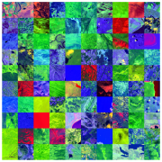
SpectralEarth is a large-scale multi-temporal dataset designed to address the current lack of comprehensive, globally representative hyperspectral datasets, which has limited the development of foundation models in hyperspectral remote sensing. It is intended for users from the AI and data mining domain to develop self-supervised and unsupervised learning algorithms on hyperspectral imagery.