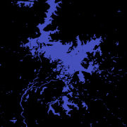
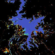
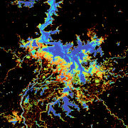
The Global WaterPack is a dataset containing information about open surface water cover parameters on a global scale. The water detection is derived from daily, operational MODIS datasets for every year since 2003. The negative effects of polar darkness and cloud coverage are compensated by applying interpolation processing steps. Thereby, a unique global dataset can be provided that is characterized by its high temporal resolution of one day and a spatial resolution of 250 meter. The daily binary layers in this collection contain information whether a pixel was detected as open surface water (1) or not (0).
The GWP maps show different water coverage categories which represent how often a location (pixel) was detected as open surface water. Dark blue color show lakes and rivers which can be considered as permanent open water, red color represents pixel which were rarely water over the year. Be aware that lake ice was not classified as open surface water. Therefore, e.g. Northern hemisphere lakes, indirectly visualize how long a lake was ice free.