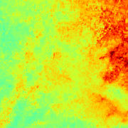
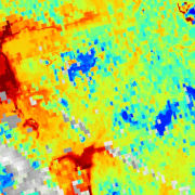
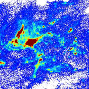
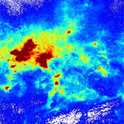
This data set contains monthly mean surface PM2.5 concentrations for Germany and parts of the surrounding countries. PM2.5 surface concentrations are derived from Aqua/MODIS and Sentinel-3A/SLSTR AOD data and provided as merged MODIS/SLSTR product. The data is generated by DLR and provided in the framework of the mFUND-Project "S-VELD".
This collection contains surface NO2 concentrations for Germany derived from Sentinel-5P/TROPOMI data. The Sentinel-5P NO2 data is generated by DLR and provided in the framework of the mFUND-Project "S-VELD". The surface NO2 data are concentrations with the unit "µg/m3". Sentinel-5P observes Germany on a daily basis.
This collection contains monthly mean surface NO2 concentrations for Germany derived from Sentinel-5P/TROPOMI data. The Sentinel-5P NO2 data is generated by DLR and provided in the framework of the mFUND-Project "S-VELD".
This product contains daily tropospheric NO2 columns for Germany derived from Sentinel-5P/TROPOMI Level-1B data. The tropospheric NO2 data are vertical column densities with the unit "µmol/m2". Sentinel-5P observes Germany once per day at ~12:00 UTC (the measurement time is included in the netCDF data file).
This product contains monthly mean tropospheric NO2 columns for Germany derived from Sentinel-5P/TROPOMI Level-1B data. The tropospheric NO2 data are vertical column densities with the unit "µmol/m2". Sentinel-5P observes Germany once per day at ~12:00 UTC and only cloud-free measurements (cloud fraction < ~0.2) are used.
The TROPOMI instrument aboard the SENTINEL-5P space craft is a nadir-viewing, imaging spectrometer covering wavelength bands between the ultraviolet and the shortwave infra-red. TROPOMI's purpose is to measure atmospheric properties and constituents. It is contributing to monitoring air quality and providing critical information to services and decision makers.
The TROPOMI instrument onboard the Copernicus SENTINEL-5 Precursor satellite is a nadir-viewing, imaging spectrometer that provides global measurements of atmospheric properties and constituents on a daily basis. It is contributing to monitoring air quality and climate, providing critical information to services and decision makers.